|
Namtok Mae Surin National Park
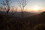
Namtok Mae Surin National Park (Thai: อุทยานแห่งชาติน้ำตกแม่สุรินทร์) is a national park in Mae Hong Son Province, Thailand. Home to mountains, waterfalls and caves, the park is best known for its namesake Mae Surin waterfall.[1] GeographyNamtok Mae Surin National Park is located east of Mae Hong Son town in Mae Hong Son and Khun Yuam districts. The park's area is 247,875 rai ~ 397 square kilometres (153 sq mi).[2] The highest point is Doi Pui peak at 1,685 metres (5,528 ft). Doi Pui is part of the Thanon Thongchai Range, whose various peaks within the park range from 300–1,700 m (980–5,580 ft).[1] HistoryIn 1981, Namtok Mae Surin was designated Thailand's 37th National Park.[1] AttractionsThe park's main attraction is its namesake waterfall, Mae Surin, a single-tier waterfall 180 metres (590 ft) in height. Another large waterfall is Pa Bong, a two-tier waterfall with a height of 30 metres (98 ft). Many of the park's streams eventually join the Pai River, which flows through the park. Nam Hu Haichai Cave is notable for being the site of a water jet erupting from the cave's interior walls at a regular interval of every 25 minutes.[3] Flora and faunaNamtok Mae Surin features deciduous and dipterocarp forests and, in higher areas, pine forests. Tree species include Dipterocarpus alatus, Pinus latteri, Terminalia bellirica and Pinus kesiya.[3] The park is home to a rare and indigenous lady slipper orchid.[1] Animal species include Malayan sun bear, Asiatic black bear, serow, barking deer, lar gibbon, wild boar, python and cobra. Bird life includes drongo and hornbill.[1][4][5] GalleryLocation
See alsoReferences
|
|||||||||||||||||||||||||||||||||||||||||||||||||||||||||||||||||||||||||||||||||||||||||||


