Road in South Korea
National Route 75 is a national highway in South Korea connects Gapyeong County to Hwacheon County. It was established on 25 August 2001.[1]
Main stopovers
- Gyeonggi Province
- Gangwon Province
Major intersections
IS: Intersection, IC: Interchange
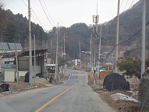 Yudong IS
| Name [2]
|
Hangul name
|
Connection
|
Location
|
Note
|
| Sincheon IS
|
신천삼거리
|
National Route 37
Prefectural Route 86
(Yumyeong-ro)
|
Gapyeong County
|
Seorak-myeon
|
Terminus
|
Changuicheon Bridge
Uleopcheon Bridge
|
창의천교
울업천교
|
|
|
| Seorak Tunnel
|
설악터널
|
|
Approximately 924m
|
| Cheongpyeong Bridge
|
청평교
|
|
|
|
|
|
Cheongpyeong-myeon
|
| No name
|
(이름 없음)
|
Prefectural Route 391
(Hoban-ro)
|
Prefectural Route 391 overlap
|
| No name
|
(이름 없음)
|
Sangji-ro
|
Gapyeong-eup
|
Prefectural Route 391 overlap
|
| (Sanyu-ri Yudong)
|
(산유리유동)
|
Prefectural Route 391
(Bukhangangbyeon-ro)
|
Galchigogae
Jangseunggogae
|
갈치고개
장승고개
|
|
|
| Hyeonchungtap
|
현충탑
|
Prefectural Route 391
(Bukhangangbyeon-ro)
|
Prefectural Route 391 overlap
|
| Gapyeong Station IS
|
가평역삼거리
|
Munhwa-ro
|
Omok Bridge
Gapyeong High School Entrance
|
오목교
가평고교입구
|
|
| Gapyeong IS
|
가평오거리
|
National Route 46
(Gyeongchun-ro)
|
| Gapyeong Fire Station
|
가평소방서
|
|
| Eupnae Police Station IS
|
읍내파출소앞삼거리
|
Biseokgeori-gil
|
Gapyeong Bus Terminal
Gapyeong Police Station
Gapyeong-eup Office
|
가평터미널
가평경찰서
가평읍사무소
|
|
| Eupnae IS
|
읍내사거리
|
Bonap-ro
|
Gapyeong Health Center
Uijeongbu District Court Gapyeong County Court
|
가평군보건소
의정부지방법원 가평군법원
|
|
| Sinmi Food IS
|
신미식품앞삼거리
|
Seokbong-ro
|
| Gyeryang Bridge
|
계량교
|
|
| Seungan IS
|
승안삼거리
|
Yongchu-ro
|
| Majang Bridge
|
마장교
|
Gakdammal-gil
|
| Norumokgogae
|
노루목고개
|
|
|
|
|
Buk-myeon
|
| Mkdong Bridge
|
목동교
|
|
| Mokdong IS
|
목동삼거리
|
Prefectural Route 391
(Hawaksan-ro)
|
| Mokdong Bus Terminal
|
목동버스터미널
|
|
|
| Mokdong 2 Bridge
|
목동2교
|
|
|
| Baekdun-ri Entrance
|
백둔리입구
|
Baekdun-ro
|
|
| Myeonghwa-dong IS
|
명화동삼거리
|
Prefectural Route 368
(Nonnamgi-gil)
|
|
Mokdong Elementary School Myeongji Branch
Sampal Bridge
|
목동초등학교 명지분교
삼팔교
|
|
|
| Domachi
|
도마치
|
|
Elevation 690m
Continuation into Gangwon Province
|
| Name [3]
|
Hangul name
|
Connection
|
Location
|
Note
|
| Domachi
|
도마치
|
|
Hwacheon County
|
Sanae-myeon
|
Elevation 690m
Gyeonggi Province - Gangwon Province border line
|
| Banam Bridge
|
반암교
|
|
|
| Gwangdeok Elementary School
|
광덕초등학교
|
Prefectural Route 463
(Pohwa-ro)
|
|
Sanae Middle School
Sanae High School
|
사내중학교
사내고등학교
|
Prefectural Route 391
(Hawaksan-ro)
|
|
| Sanae Police Station
|
사내파출소
|
Sanae-ro
|
|
Sanae-myeon Office
Changam Bridge
|
사내면사무소
창암교
|
|
|
| Sachang-ri
|
사창리
|
National Route 56
Prefectural Route 56
(Supiryeong-ro)
|
Terminus
|
References
- ^ 대통령령 제17348호 일반국도노선지정령, 2001년 8월 25일 전부개정.
- ^ Intersection and interchange are also included, as well as buildings and facilities in the surrounding area
- ^ Intersection and interchange are also included, as well as buildings and facilities in the surrounding area
|
|---|
| South-North | | |
|---|
| West-East | |
|---|
†: Hypothetical national highways on the territory of North Korea in the case of reunification
: Abolished national highways |
.jpg)
